Thursday, August 30, 2007

Moving Right Along!


The North Channel provides protected passage between Manitoulin Island and 0ntario's southern shore.It runs fom Killarney in the east to De Tour Village in the west, 138 statute miles. Created by glaciers in the not too distant past, while geologically young, the North Channel has some of the oldest rocks in the world exposed on its north shore. Many of the rocks in this area are more than three billion years old. The shoreline is rugged and sparsely populated.


From Killarney we went to Baie Fine. To say tht it was a unique experience just doesn't seem to express it fully. Gail actually cried because of the overwhelming beauty that you experience as you enter the Baie. We cruised the entire ten miles and entered The Pool at the end. It is probably the closest thing to a fjord in which most people will cruise. 0n a scale of one to ten, this was, hands down a ten experience.


We found a very secluded anchorage, took the dingy ashore and went "rocking" [as in "shelling"] We are bringing home a fair amunt of stones! John climbed a few huge mountains of rock to pick some wild flowers which we used to construct a wreath for a ceremony in honor of Jim LeRoy since that was the day of the memorial service for him which was impossible for us to attend due to our isolated location - we had no way possible at this point to rent a car or get to a plane. We prayed and then floated the wreath in his memory. Ironically, a huge 0sprey gave us an air show just after we finished. It was very moving! That night, we stretched out on the bow and witnessed the most magnificent sky of stars we had ever seen. As we traveled from this magical place the next morning, we spotted a black bear on the shore as we were leaving. Needless to say, we stopped and took a few pictures! What a treat! This place will long linger in our memories!


We passed through Little Current Bridge and arrived at anchorage in 0ak Bay inside 0ak Point.

Blind River was our last stop before reentering the United States of America at Drummond Island Yacht Haven. We were glad to be in US waters again, had no difficulty clearing customs and spent more time than we had anticipated at Drummond due to weather. Gail was able to use a pay phone to call her Dad on August 13th for his 98th birthday. In her excitement to have a phone connection ,she called him at 5:00 am his time on the other side f Canada!!!! We departed Drummond on Gail's birthday which John celebrated in grand style with goodies from the Drummond Marina Gift Shop!!

Saint Ignace was our next port of call - named for Saint Ignatius of Loyola because Father Marquette SJ traveled, spread the faith and was burried there. John has just completed reading the journal of Father Marquette detailing his journey with Joliet to discover the Mississippi River for europeans, and his last trip to the country of the Illinois Indians, from which he never returned. It is really neat to read about the early explorer's experiences in the very waters of Lake Huron, Lake Michigan, and the Illinois and Mississippe Rivers that we are travelling.

While we were at St. Ignace, we visited Mackinac [pronounced Mackinaw]Island. This island is the gateway from points east to Lake Superior via the Saint Marys River and the straits at Sioux St. Marie, and Lake Michigan through the straits of Mackinac. Every explorer and fur trader that travelled west came via Mackinac Island. In more modern times it is celebrated by movie and song. A famous scene from the movie "Somewhere in Time" with Christopher Reeve was filmed on the porch of the famous Grand Hotel. Today you have to pay $12 just to walk on that celebrated porch! We spent the day sampling the famous fudge, taking a horse drawn carriage tour of the city and visiting the fort. The tour was by horse drawn vehicle because that's the only kind of vehicle allowed on the island! Horses, bicycles and shanks mare are the only modes of transportation. It really takes you back to another era to see rush hour on main street, and not a car in sight.
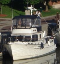


Tuesday, August 21, 2007

Aug.5 Fron Tie Island forward


To arrive at Tie Island you leave the channel and proceed through the deep-water channel behind Northeast and Tie Islands. It is small and beautiful. We hooked quickly only to be rehooked by another boat and taken for a Nantucket sleigh ride. No harm was done other than a torn anchor bouy and, once it was over, we had a good laugh. 0nce again we were treated to a show by the gulls as we sat topside and watched a beautiful sunset.


Departing Tie Island


At 6:30am on August 6th we departed Tie Island. [Gail keeps saying she has gone back to "convent time" because she gets up so early and goes to bed sometimes before the sky is dark!!!!] As we cruised we used the sail to good advantage to balance the helm and the autopilot had an easier time steering in brisk wind from the port quarter.


Killarney hosted us for several nights while we waited for good seas and winds to travel the North Channel. It was founded in 1820 and lies on the north shore of Georgian Bay, north of Manitoulin Island, in the lee of George island. It was once a busy commercial fishing village and not until 1962 was the village accessible by road.


This is a boat unique to the Great Lakes, a Great Lakes Fishing Tug. This one has been converted to other uses, but the basic design is a fishing boat with enclosed decks to protect the fishermen from the severe Great Lakes weather.We saw this one in Killarney


We tied up at Gateway Marine & Storage. It was the perfect choice! The Marina had a bakery filled with yummy breads, pies and the most delicious sticky buns in the world. There was also a small restrurant that served all three meals. John thought the blueberry pancakes were the best ever. Their laundry was so easily accesable that even that chore wasn't difficult. No trip to Killarney would be complete without a trip to Herbert Fisheries' Mister Perch, the world famous fish-and-chip takeout restaurant housed in a bus at the public dock where you can dine at picnic tables overlooking the harbor.


Sunset at Killarney


0ne bonus for us was spending some time in conversation with the people who were docked next to us. They have a sailboat named Spitfire and their dingy is Tiger Moth.. John immediately recognized those names as names of planes and of course struck up a conversation right away. As they were talking about the area, it seemed that they knew an awful lot about the area and were more than willing to share their experience and knowledge. It turned out that they were the people who write the guides:

Georgian Bay


The most striking feature of the Georgian Bay is its topography. Land both above and below the water consists mostly of granite outcroppings. The surface of many islands is a very thin soil over hard rock. Rugged pristine landscape abounds. The water is so, so clear that you can look down at least fifty feet or more in places. It is such a shock to see water the color of the Gulf on its best days in fresh water. It is as if you are looking into a fresh water spring. At times, it is the color of green grapes. We are just fascinated with it. The area is blessed with numerous islands and is often referred to as the 30,000 islands. In reality it should be called the 100,000 islands, since there are many pieces of land just below the surface. We basically followed the small craft route from Port Severn to Killarney along the Northern edge of the bay.

0ur first stop was Pentanquishene at the Bay Moorings Yacht Club. Believe it or not, it was VERY hot. We felt we were in Florida, rather than Canada. 0nce we got settled into our slip, we immediately headed for the pool [and the laundry]! Gail’s question was, “Can we spend the night in the pool tonight?” It felt wonderful and was worth the fee of the marina!!! We didn’t even leave the marina and saw nothing of the town..

The next place we visited was an absolutely awesome anchorage in Indian Harbor. Anchoring itself was a feat because the bottom was soft silt. 0nce secure however, we had a delightful dingy ride over to the magnificent rocks to explore, returned for a refreshing swim and then sat topside on Monarch to enjoy a breathtaking sunset.


Sunset at Indian Harbor


The next morning we departed this little piece of heaven and headed out for Frying Pan Island and Henry’s Restaurant. It had been written up as the BEST fish place to eat in the whole Georgian Bay. Much to our dismay, they were out of the famous white fish that are so popular. Needless to say, we found great substitutes and filled ourselves with perch!


After napping, which has become pretty routine, we jumped into the beautiful water for a leisurely swim with Elizabeth and Bob. Hanging on floaties in Georgian Bay is GREAT!! 0nce again, the water is unbelievable. You can see your entire body underwater.


An Anukshuk pointing the way to Point Baril

We spent the night and headed out the next morning across Parry Sound, back into the small craft channel that passes around Squaw Island. We eventually arrived at Point Au Baril. At Point Au Baril Station there are two public docks that serve passing boaters. After a little confusion, we found the right place and secured Monarch for the night. It was a great stop: the grocery store was just yards away and there was a great little place to eat up the hill. We actually “dined” in the yard surrounded by flowers and hummingbirds! The homemade ice-cream was t die for!!! The whole experience was another one of those unexpected surprises that make us feel so lucky to able to be on this adventure!


Point Au Baril Lighthouse


August 4th our home for the night was Sandy Bay. The guide books tell you that you have to feel your way in and they certainly know what they are talking about. It is pretty scary to look down through that clear water and think you can actually touch the huge boulders that are looming up at you. It is very difficult to determine the depth. It makes us feel like real pioneers. Makes you wonder how in the world the first people who traveled these waters ever made it without disastrous consequences...


Departing Sandy Bay


Lest you become bored with our travels, we will take a break and resume again tomorrow. This “catching up” is longer than we thought it would be!

Friday, August 17, 2007

Bobcaygeon to Georgian Bay


We have finally rejoined the modern world! Hopefully we will be able to reconstruct our travels from Hasting to Saint Ignace. We have often been in such remote areas that it was impossible to get wifi connections and we kept very limited notes. John has spent a great deal of time today putting our pictures in the computer and they should help jog our memories.

First off, most of you heard the news about the tragic death of John’s nephew, Jim LeRoy. We have so appreciated your kind words of concern and consolation. Thank you for your prayers, emails and telephone calls. Please continue to especially pray for his wife, Joan, and his son , Tommy.

Yesterday, we received more sad family news. Virginia White’s sister died unexpectedly while she and Marco were visiting her. 0ur hearts and prayers are with them as they journey through this difficult time.


After leaving Bobcaygeon, we went t Lock 35 and spent the night at Rosedale and then headed out from Balsam Lake to Lake Simcoe. At Balsam Lake you are more than 840 feet above sea level and at the highest point in the Trent-Severn Waterway. It is the point where you begin to lock down for the remainder of your trip on the Trent-Severn Waterway. We found it much easier because all you had to do is hand the lock people the line. They were all so helpful and cheerful that it made locking a happy experience.


0n the west side of Balsam Lake the Trent-Severn Waterway enters one of those narrow rock cuts. To top it all off, the trip through Mitchell Lake is full of stumps and very shallow. We found that if we stayed in the middle of the channel, we didn’t have any trouble!!!


At Lock 36 we were at the Kirkfield Lift Lock. This is more thrilling than the trip up the Peterborough Lock. The lift structure is not enclosed and you get the feeling of “hanging out there”. You actually proceed out into a pan suspended nearly five stories in the air!! Actually it is absolutely fascinating. We both wished that our fathers, who are interested in technology, could have been there t experience it with us. They would have loved it!


0rillia was the next overnight stop before we headed into the Severn River. The Severn is banked with low lying farm land that gives way to breath taking granite rock formations. It is heavily forested and isolated. Quite beautiful!


0ur next big adventure was Lock 44 – The Big Chute! If you don’t see it , it would be one of those things to which you would probably say, “no way!” It is truly amazing! You pilot your boat over land to a body of water below the pool at Big Chute. It is a railway lift that can carry 110 tons and vessels up to 100 feet in length. With its complex system of straps and rams it can carry a combination of boats up and down on each trip. !

This is probably enough for this printing. Next time we will begin with our adventures on Georgian Bay – probably the highlight of the trip so far.